July 6, 2007
Time of departure: 8:10 A.M.
Temperature: 41 degrees
Elevation: 7080 feet
Total Mileage: 149
“No, I’m sorry. The road leading down from Marshall Pass is totally washed out, and is impassable by all vehicles” said the woman on the phone.
It was the second time in the day we’d been turned around. On our first attempt, luckily, we had found the pass was closed before we rode the 25 miles to find out in person.
On the road to the second pass, we passed a sign telling us of our impending doom, if we didn’t turn around. Actually, I didn’t see the sign, Meredith and Dad did. I had my head up my butt, apparently.
The sign gave a number to call, I guess for the people, like us, who didn’t want to believe the sign. We did call, and the nice lady told us that the sign was no joke. So around we turned.
On to route number three. We headed west on U.S. 50, towards 11,000 foot Monarch Pass. For a second alternate, it was a very good ride. We made the pass in less than an hour.
We continued on down the other side, following U.S. 50. We traveled for a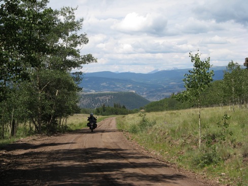 few more miles and turned southwest.
Soon, we were back on gravel, headed for Los Pinos Pass, at 10,500 feet. We achieved the pass around lunch time. So, we sat and had lunch.
While we were sitting in the high meadow, two rather large bull elks ambled into the clearing, looked at us once, and walked on.
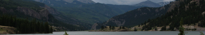
After lunch, we moved on down the road. Soon, we came to Lake City, CO. Since it was still early(1 P.M.), we decided to have a drive around Lake San Cristobal, the town’s namesake. It was very pretty to say the least.
Since then, we’ve been sitting on our motel room porch and enjoying the cool weather and views. We better enjoy it. It’s gonna get hot.
See y’all down the trail.
Ron and Meredith