July 8, 2007
Time of departure: 7:30 A.M.
Temperature: 60 degrees
Elevation: 7066 feet
Total Mileage: 168
“Hmm, the map really isn’t clear on which fork I should take,” I said, as I sat in a landscape that resembled the moon. The road split in two. Our map showed no other road.
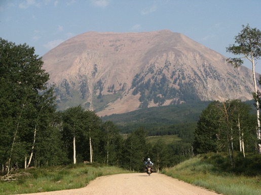
We began our day in Monticello, Utah. We drove north and soon were climbing the La Sal mountains. The environment, to our surprise, was soon alpine. We, once again, were treated to aspen glades and mountains over 12,000 feet. The views were great.
We saw several deer. They seemed more like goats though. At one point, we rounded a corner to see three doe in the road, with a vertical mountain to the left and a steep drop to the right. In several easy bounds, all three were up the mountain.
Soon after we saw a grouse and a marmot.
All things that go up must come down. The trail then took us down in elevation to the red rock town of Moab, Utah.
Moab is an interesting sight. Situated on the Colorado river and the edge of the vast area of the Utah canyon lands, its sole purpose seems to be to cater to mountain bikers and rafters. Also, Arches National Park is a short distance from town, bringing in R.V.’s of all types.
We made Moab around 11 A.M., had an early lunch, and skipped town as soon as possible.
If the morning scenery was one extreme, the afternoon was the exact opposite.
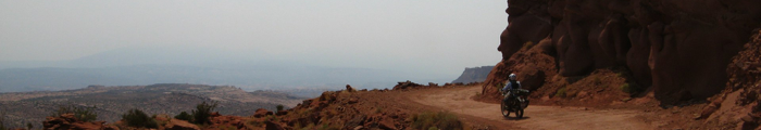
Red rock canyon land is unique, to say the least. At times you feel like you’re on the moon, the next, Mars, but never Earth. We rode north of town for a few miles and tu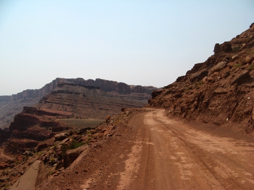 rned northwest. The road switchbacked up a ridge. The sight and ride were amazing.
Sand, rocks, and more sand became the order of the afternoon.
You might notice in the pictures the haze in the air. Several fires are in the area, creating a smoky view. Such is life in the summer.
Towards the end of the day, we approached our destination of Green River, Utah. The scenery decided to show us one last view for the day, a white, cl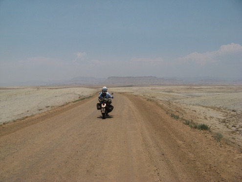 ay-based dirt. Conspiracy theorists could easily say this was where the government faked the moon landing.
Utah has proven to be varied. We can’t wait for more.
We plan on staying in Green River tomorrow. Bike maintenance is needed and body maintenance, too.
Unless something really exciting happens tomorrow, we’ll pick up our writings on Tuesday.
See y’all down the trail.
Ron and Meredith