June 18, 2007

Time of departure: 7:02 A.M.
Temperature: 70 degrees
Elevation: 5 feet
Total Mileage: 214
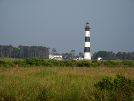
I was surprised. I had figured the drive up Hatteras National Seashore from our starting point of Avon, N.C. would be terrible, mainly from traffic. Instead, since we departed at the relatively early hour of 7 A.M., the traffic was light, and, of course, the view was great.

We rode north and arrived at the famous Kitty Hawk, North Carolina. Of course we had to see the legendary field where Orville Wright made his historic flight.
We arrived before the museum opened but were allowed to see the field where it occurred.
It was an interesting place in that, “well, there’s where it happened,” sort of way. But other than the fact that the flight happened there, the field doesn’t look any different than many of the other fields in the area.
The coast in this area is very interesting. Unlike most places on the Gulf Coast, the beaches here have many trees very close. And if you move inland no more than a few miles, the trees become forests. The tree types are varied, but pines are the predominant species.
After leaving Kitty Hawk, we turned west and crossed the Wright Brothers Memorial Bridge, carrying us over the Albemarle Sound. It was the last time we were to see the salt water on the eastern coast.
The land continued to be flat with trees in clusters, punctuated by fields of corn and peanuts. As we moved west, we crossed several canals that, if you followed them east, would take you back to the Atlantic.
We stopped for lunch, in the small town of Boydton, N.C., at the only eatery in town. The establishment also claimed to be a pharmacy and video store.
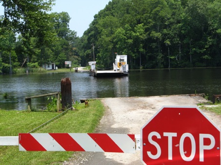
After lunch we moved west and came to the Meherrin River. The road had turned to gravel and, as we came to the river, a stop sign halted our progress. Another sign said, “please blow horn for ferry.”

The ferry was powered by a diesel engine and guided by a cable that stretched across the river. In a few minutes, we boarded.
The crossing took a few more minutes, and, soon, we were on our way.
As we traveled west, the peanut fields became more prominent.
At one point, we rounded a bend and were struck with an interesting sight. Beside the road, alone in a peanut field, was a church the size of First Baptist in Athens. No other buildings were close. The sign said it was Methodists. Traveling Methodists, obviously.
Almost all roads are paved here. Besides the few miles around the ferry, we saw almost no unpaved roads. Settlements are very close to each other, and houses are everywhere. Also, there seems to be not much poverty. Most houses are nice.
Soon, we were getting close to our destination of Roanoke Rapids, N.C. Just before we arrived, we crossed the beautiful Roanoke River. It was a good way to close the day.
See y’all down the trail.
Ron and Meredith
