June 21, 2007

Time of departure: 7:15 A.M.
Temperature: 57 degrees
Elevation: 2087 feet
Total Mileage: 194
Plate tectonics is an amazing phenomenon. The idea that the land on the earth is moving in one direction or another has many interesting consequences. One of which is the fact that, at one point, the Appalachian Mountains were as tall, or taller, than the Himalayas.
Many millions of years later, the Appalachians are just a shadow of their former selves. But wow, it’s a beautiful shadow!
We awoke this morning in Abingdon, Virginia to clear skies and cool temperatures. Working our way west, we began crossing fold after fold of mountains with names that invoke visions of early mountain men leading the way west. Indeed, by the end of the day, we would see maybe the most famous mountain fold in America.

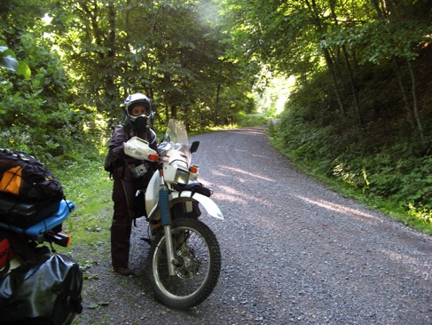
At one point, we actually came to a gravel road. I was surprised. I never really expected to find gravel in Virginia.
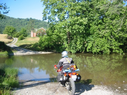
Several miles down the road, we rounded a bend and was faced with a sign declaring there to be a water crossing within the next half mile.
The creek wasn’t particularly large, maybe 50 yards across. But I knew the crossing wouldn’t be easy since I couldn’t easily see the bottom. I killed the bike and surveyed the situation. But, without any options, beside going through, I didn’t wait long. In, I plunged.

Also, luckily, a foot bridge led across the creek. I decided it would be better for me to ride Meredith’s bike across. I was thankful for the bridge.
Both bikes across, we kept moving. A quarter-mile later, another crossing awaited us. This time, maybe the water was a little shallower. I crossed and then Meredith crossed. Hurray!
As lunchtime approached, we came to Cumberland Gap National Historical Park. We had always heard about Cumberland Gap and the Cumberland Ridge. Now, we could see it.
In the 1750’s, a fur trapper, looking for a way west into Kentucky, found the Gap and named it after Lord Cumberland. Twenty years later, Daniel Boone would use it to lead settlers west. A Gap, by the way, is a just another word for a low spot in a mountain ridge, allowing passage.
Modern day travelers don’t actually use the Gap anymore. A mile long tunnel carries traffic from one side of the ridge to the other. The experience of riding the bikes through the tunnel was unique.
After lunch we moved on towards our destination of Jellico, Tennessee. By 3:30 P.M. we had arrived.
See y’all down the trail.
Ron and Meredith
